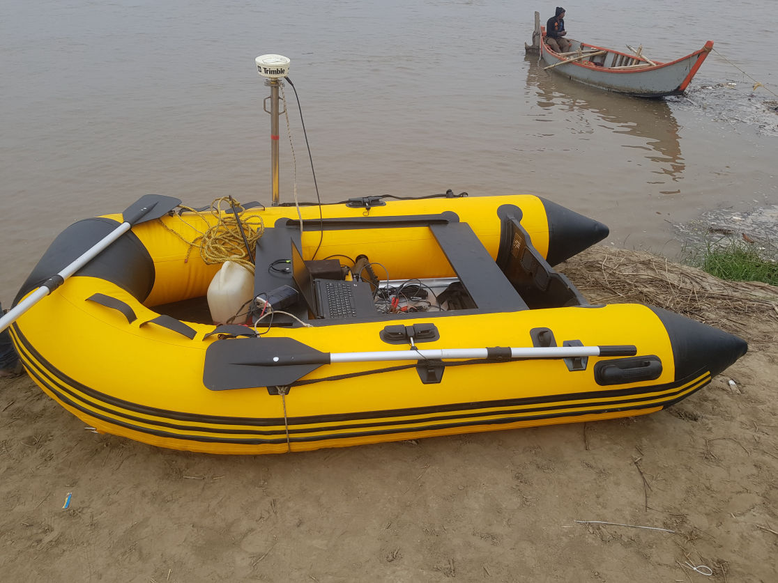
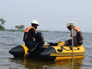
Mobirise

     OUR SERVICES

Seabed/Geophysical Surveys

Mobirise

Bathymetry Survey

Bathymetry is the measurement of the depth of water bodies like oceans, rivers, or lakes. The bathymetry is mainly used for Pre-dredge, dredge monitoring, post-dredge activities, Navigation, Pipeline laying, Jetty/Wharf/breakwater/seawall/reverent constructions, shoreline changes/monitoring, calculating de-silting quantity, channel design etc.,
We do bathymetry by using Teledyne Odom MK III, Odom Echotrac CV 100, Syqwest Bathy-500, R2 Sonic 2024 with Trimble marine grade RTK DGPS positioning systems and HYPACK 2021

Mobirise

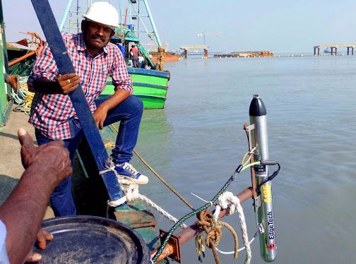
Side Scan Sonar Survey

Side scan sonar is a seafloor mapping tool to identify fallen object/debris, exposed rocks and sediment distribution on seafloor. The Side scan sonar is generally used for planning of jetty/Wharf/breakwater/seawall constructions, Offshore navigation, Dredging projects, Pipeline laying, channel design, finding fallen objects/debris on floor etc.,
We perform Side scan sonar survey by using Edge-tech 4125 and Kongsberg Geo-Acoustics 159D side scan sonar systems with Trimble marine grade RTK DGPS positioning systems.

Mobirise

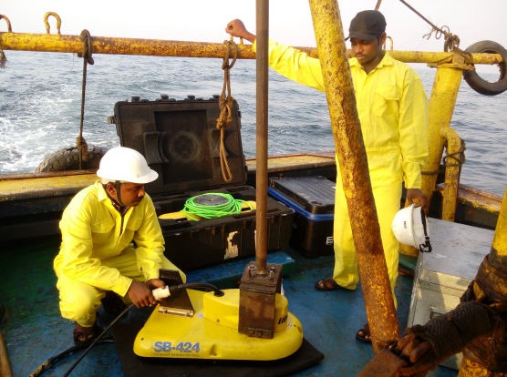
Sub-bottom Profile Survey

Shallow seismic/sub-bottom profile survey is a tool to study the sub-seabed which helps to identify the buried rocks/man-made objects and sedimentary formation under seabed.The Shallow seismic/sub-bottom profile survey is generally used for planning of jetty/Wharf/breakwater/seawall constructions, Navigation, Dredging projects, Pipeline laying, channel design, finding buried objects/debris under floor etc., NISVO carries out shallow seismic/sub-bottom profile survey by using Edge-tech 216S and Geopulse sub-bottom profilers with Trimble marine grade RTK DGPS positioning systems.

Mobirise

Coastal Topographic Survey

Topographic data shows the shape or configuration or relief or vertical profile of a surface/coastal/river-bunds etc.

For field data acquisition, NISVO uses
• Trimble RTK DGPS systems
• Leica RTK DGPS systems
• Leica Total stations
• Sokkia Total station

Mobirise

Magnetometer Survey

Magnetometer surveys are used in a variety of fields, and are particularly well suited to the detection and mapping of all sizes of ferrous objects including anchors, chains, cables, pipelines, ballast and other scattered shipwreck debris, munitions (UXO), aircraft, engines and any other magnetic objects. A magnetometer measures variation in the earth’s magnetic field and can be used to detect anthropogenic features on the seabed, buried on land or alternatively to assist in the mapping of geological features. We use the SeaSpy Marine magnetometer for field studies.

Mobirise

Core Sampling

A core sample is a cylindrical section of (usually) a naturally occurring substance. Most core samples are obtained by drilling with special drills into the substance, for example sediment or rock, with a hollow steel tube called a core drill.

Metocean Measurements

Ocean currents continue movement of water which plays a major role in ocean engineering. The current measurements are essential to generate models for planning offshore structures such as breakwater, seawall, revetment, jetty etc.

The alternate rising and falling of the sea, usually twice in each lunar day at a particular place, due to the attraction of the moon and sun is the tide. Tide measurements are essential to generate models for planning offshore structures such as breakwater, seawall, revetment, jetty etc.

Waves are formed due to various forces acting on water according to different weather conditions. Studying different wave parameters helps to generate models for planning offshore structures such as breakwater, seawall, revetment, jetty etc.

Wind speed and directions involve many ocean related activities and environmental studies to achieve perfect planning on ocean engineering..

Mobirise

Oceanographic Studies

Mathematical Modeling

Numerical modeling is a broadly applied method to tackle complex coastal dynamic problems through computational simulation of hydrology scenarios. The modeling study helps for planning offshore structures such as breakwater, seawall, revetment, jetty etc., and intake, outfall pipeline projects.

Chemical Oceanography

Chemical properties of seawater are studied by taking samples at appropriate locations and analyzing for various parameters such as Temperature, pH, Salinity, Dissolved Oxygen, Biochemical Oxygen Demand, Turbidity, Ammonia-N, Nitrite-N, Nitrate-N, Inorganic Phosphate, Total Suspended Solids, phenolic Compounds, Petroleum Hydrocarbons, Cadmium, Lead, Mercury, Chromium etc., These studies help to understand the environmental conditions of project sites.

Marine Biology

Marine biology studies help to understand the environmental conditions of biological parameters such as primary productivity, phytoplankton, its biomass and diversity, zooplankton, its biomass and diversity, macro benthos, its biomass and diversity, microbial population in water and sediments, mangroves and sea weeds, biological status of floral and faunal communities etc., in the project locations.

Mobirise

NISVO MARINE SURVEYS

Address

Plot No. 18, Meadow Villas,
Phase II, CTO Colony 3rd Street Extn., West Tambaram, Chennai, Tamil Nadu - 600045
Phone : +91 9894754343 


Contacts

Email: projects@nisvo.com
            oceannisvo@gmail.com 
Phone: +91 9894754343
              +91 9894715075

...

Feedback

Please send us your ideas, any feedback would be appreciated.